Space-Based Disaster Monitoring: Satellite Insights from AFR!
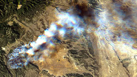
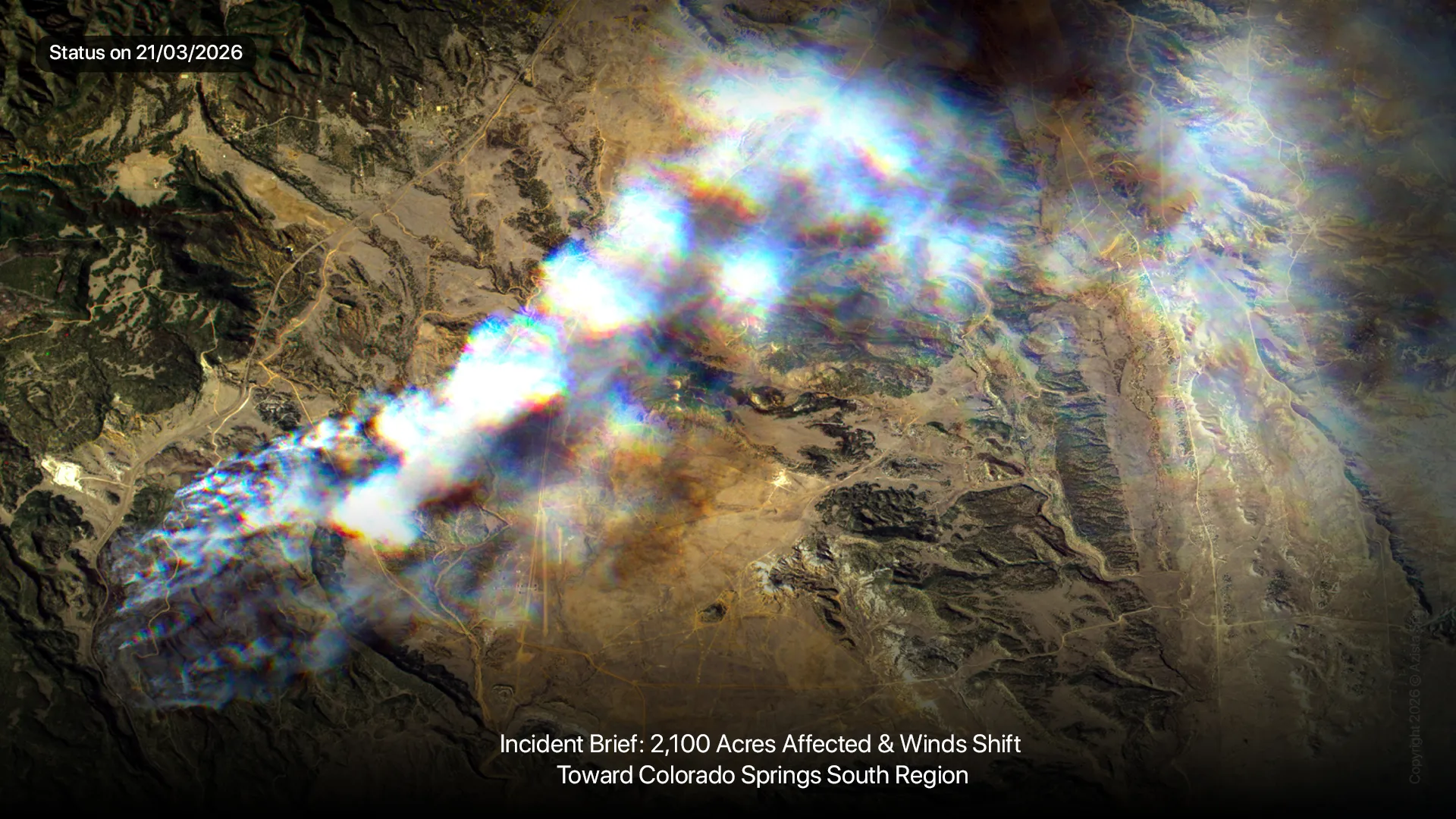
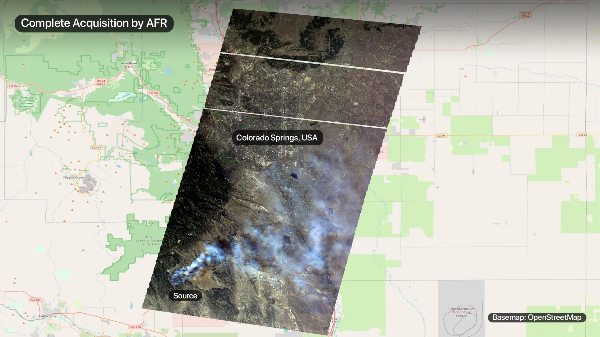
On March 18, 2026, a rapidly spreading wildfire broke out south of Colorado Springs. To support disaster management and situational awareness, our team utilized our AFR satellite to perform a complete acquisition of the region.
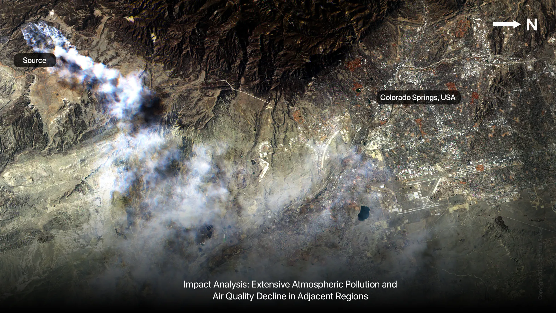
These images, captured on March 21, 2026, at 21:46:10 UTC, highlight the critical role of high-resolution satellite monitoring in evaluating remote disaster zones, tracking active fire lines, and assessing secondary environmental damage.
Key Observations from the AFR Imagery
- Extent of Damage: Initial assessments indicate that 2,100 acres have been affected by the incident at the time of imaging.
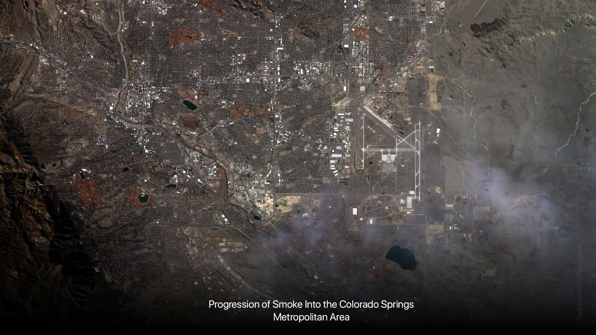
- Environmental Impact: The data reveals extensive atmospheric pollution and an air quality decline in adjacent regions. We can clearly observe the progression of smoke into the Colorado Springs metropolitan area.
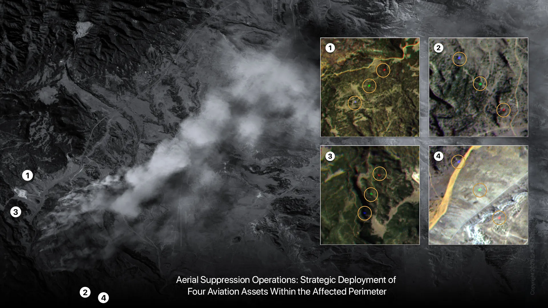
- Containment Efforts: Ground crews are working tirelessly as Highway 115 remains closed to the public. Our satellite also detected active aerial suppression operations.